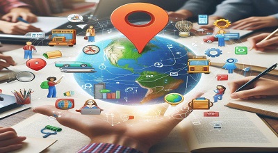
Google Maps in Education
Now Google Maps is a web mapping service that provides various features such as satellite imagery, street maps, 360° panoramic views, real-time traffic conditions, and route planning. Google Maps can be used in education for various purposes, such as:
Exploring different places and cultures around the world. Google Maps allows students to virtually visit any location on the planet and learn about its geography, history, culture, and landmarks. For example, students can use Google Maps to explore the architecture of Barcelona, trace Marco Polo’s journey through Asia, or view the life cycle of water.
More here…
Developing spatial thinking and map skills. Google Maps helps students to understand the concepts of scale, distance, direction, location, and coordinates. Students can also use Google Maps to create their own maps and stories by adding points, text, and multimedia content. For example, students can use Google Maps to create a map of their neighborhood, a historical timeline, or a fictional story.
Enhancing cross-curricular learning and collaboration. Google Maps can be integrated with other subjects and tools to create engaging and interactive learning experiences. For example, students can use Google Maps to study the effects of climate change on different regions, to analyze the habitat of the Cameroon grassland frog, or to join Carmen Sandiego on her capers around the globe. Students can also share their maps and stories with others and collaborate on projects using Google Maps.
Benefits of Google Maps in Education
Google Maps offers several benefits in the field of education, providing valuable tools and resources for both educators and students. Here are some of the key benefits:
- Geography Education: Google Maps is an excellent tool for teaching geography. It allows students to explore and understand the physical features of the Earth, such as continents, countries, rivers, mountains, and more. Teachers can use the platform to create interactive lessons that engage students in exploring the world.
- Virtual Field Trips: Google Maps enables virtual field trips to virtually any location around the globe. This is particularly beneficial for schools with limited resources or for exploring places that are logistically challenging to visit. Students can “visit” historical sites, natural wonders, and cultural landmarks without leaving the classroom.
- Cultural Awareness: By using Google Maps, students can gain a better understanding of different cultures and communities. Exploring street views, landmarks, and local businesses allows students to experience the diversity of the world, fostering cultural awareness and global understanding.
- Customized Learning: Educators can create custom maps to support specific lessons and learning objectives. These maps can include annotations, markers, and other interactive elements that enhance the learning experience. Teachers can tailor maps to match the curriculum and make them relevant to the subject being taught.
- Collaborative Projects: Google Maps facilitates collaborative projects among students. They can work together to create and edit maps, add information, and share their findings. This promotes teamwork, communication, and critical thinking skills.
More Benefits…
- Historical Perspectives: Google Maps’ historical imagery feature allows students to explore changes in landscapes over time. This can be particularly valuable in history classes, helping students visualize historical events and understand how geography has evolved.
- Data Analysis: Google Maps provides tools for data visualization and analysis. Students can use the platform to create charts, graphs, and other visual representations of geographic and demographic data, enhancing their analytical skills.
- Career Exploration: Google Maps can be used to explore different regions and cities, providing insights into urban planning, infrastructure, and various industries. This can be beneficial for students considering careers in fields such as geography, urban planning, or environmental science.
- Accessibility: Google Maps is easily accessible and can be used on various devices, making it a versatile tool for both classroom and remote learning. It offers a user-friendly interface that students and teachers can navigate with ease.
- Real-world Applications: By incorporating Google Maps into lessons, educators can show students the real-world applications of geography and spatial analysis. This helps students understand the relevance of their studies and how they can apply geographic concepts in various contexts.
Note:
Overall, Google Maps enriches the educational experience by providing a dynamic and interactive platform for exploring the world and enhancing learning across different subjects.